
| Description | Code |
|---|---|
| Lat/long, WGS84 | 4326 |
| UTM Zone 10, WGS84 | 32610 |
| UTM Zone 11, WGS84 | 32611 |
| UTM Zone 10, NAD83 | 26910 |
| UTM Zone 11, NAD83 | 26911 |
Lecture 17: Spatial Data
2026-04-09
Coordinate Reference System (CRS)
- Geographic Coordinate Systems
- Treat the Earth as a spheroid (not flat).
- Depends on the datum.
- Expresses locations in units of degrees.
- Latitude = N/S (y-coordinate).
- Longitude = E/W (x-coordinate).
- Treat the Earth as a spheroid (not flat).

Coordinate Reference System (CRS)
- Projected Coordinate Systems
- Project the round Earth onto a flat plane.
- Planar coordinates obey properties of flat geometry
- E.g.,
- Parallel lines never meet
- Angles of a triangle sum to 180°
- \(a^2 + b^2 = c^2\) holds (Pythagorean theorem)
- E.g.,
- Units are linear
- Usually meters, sometimes feet
Coordinate Reference System (CRS)
- Projected Coordinate Systems
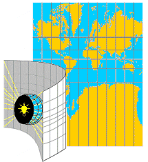
- Projections can be thought of as shining a light through the globe and tracing the resulting map on a flat surface.
- Mostly a metaphor, although some simple projections literally work this way.
- Projections can be thought of as shining a light through the globe and tracing the resulting map on a flat surface.
Coordinate Reference System (CRS)
- Projected Coordinate Systems
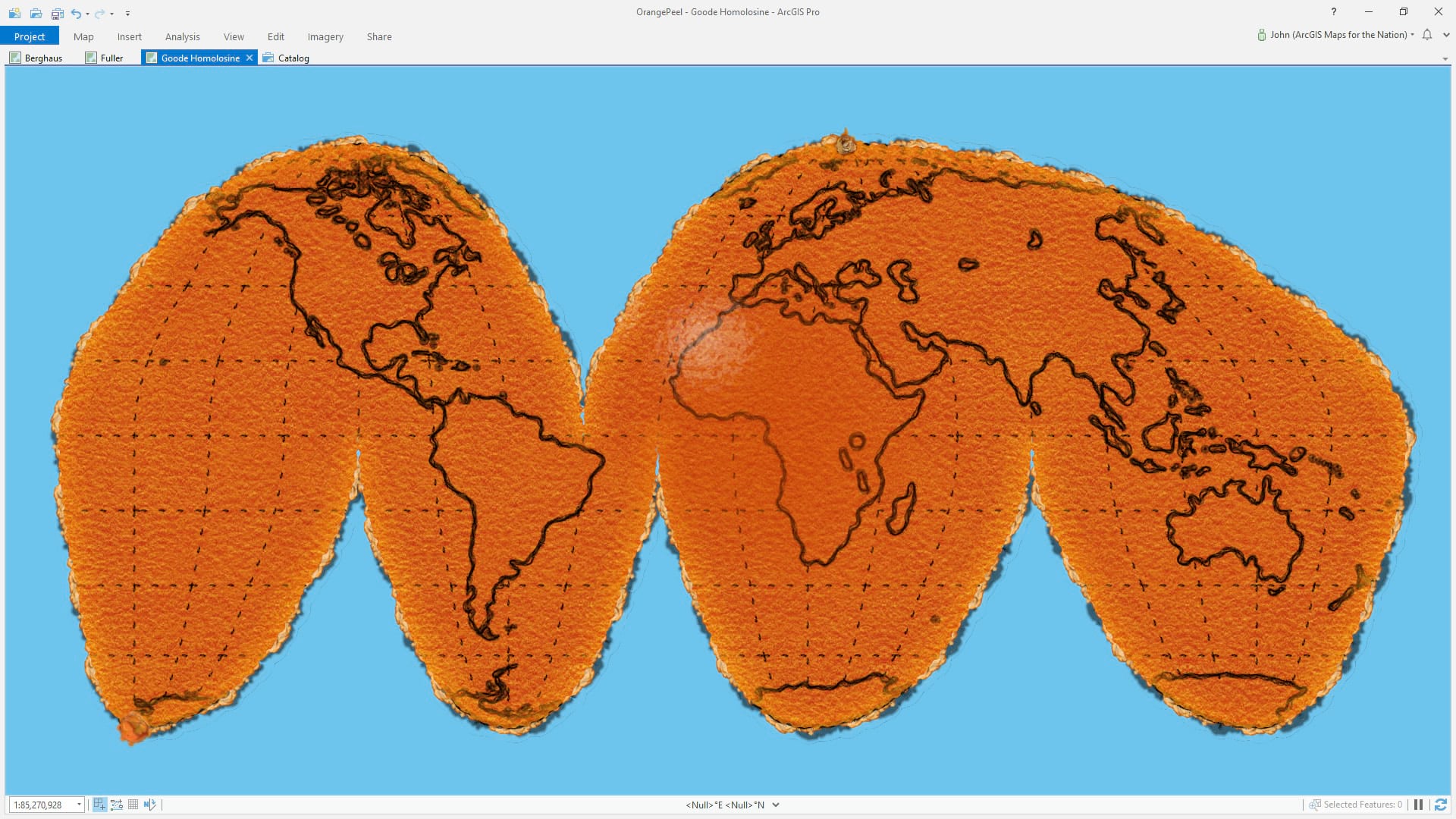
- Projections all come with tradeoffs, since the surface of the Earth is not truly flat.
- Something must get distorted.
- Often illustrated with the orange peel metaphor.
- Projections all come with tradeoffs, since the surface of the Earth is not truly flat.
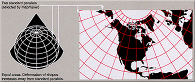
Coordinate Reference System (CRS)
- Projected Coordinate Systems
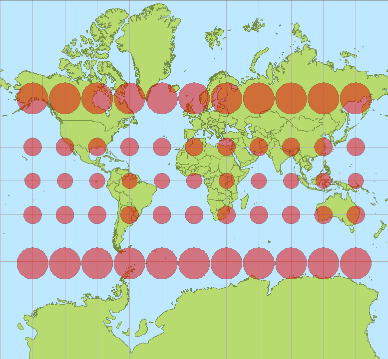
- No projection can preserve all the properties of a map.
- Area
- Shape
- Direction
- Bearing
- Distance
- No projection can preserve all the properties of a map.
Coordinate Reference System (CRS)
- The Wikipedia article on map projections has a lot of great details.
Coordinate Reference System (CRS)
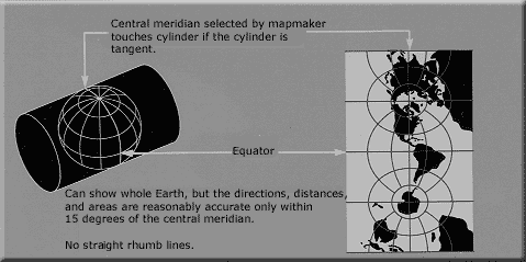
- Universal Transverse Mercator (UTM) projections.
- Use the transverse Mercator projection, which has minimal distortion along the central meridian.
- Minimizes distortion by using 60 different central meridians, defining 60 different “zones”.
- Units are meters.

Coordinate Reference System (CRS)
- Datums*
- The most common datum today is WGS84, which defines both the reference frame and an ellipsoid of the Earth.
- WGS84 is the standard that GPS relies on.
- Other older datums are often region specific, e.g.:
- NAD83
- NAD27
- The most common datum today is WGS84, which defines both the reference frame and an ellipsoid of the Earth.
Coordinate Reference System (CRS)
- Some useful EPSG codes:
Data Types
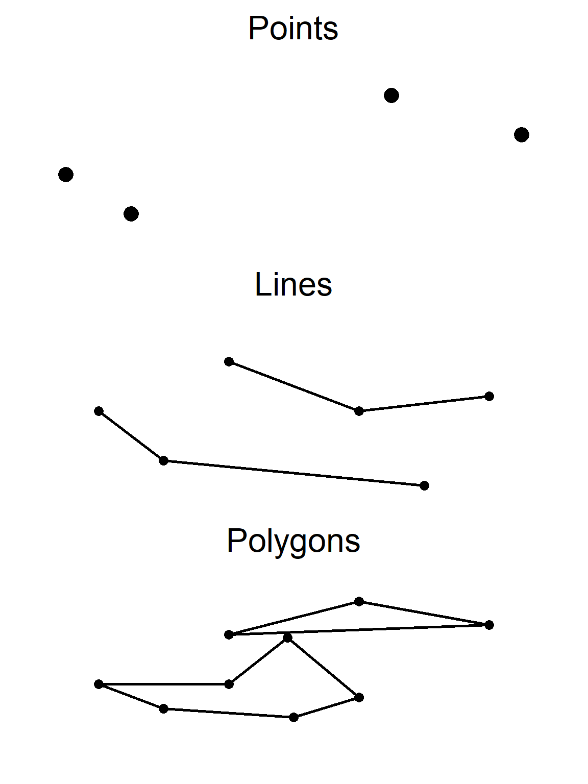
- Vector
- Point, line, or polygon.
- (Other less common classes exist).
- Store coordinates of vertices and their attributes.
Data Types
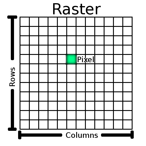
- Raster
- Gridded data.
- Most often square; sometimes rectangular or hexagonal.
- Often represent continuous values in discrete space.
- Store coordinates of origin, cell dimensions, and values.
- Gridded data.